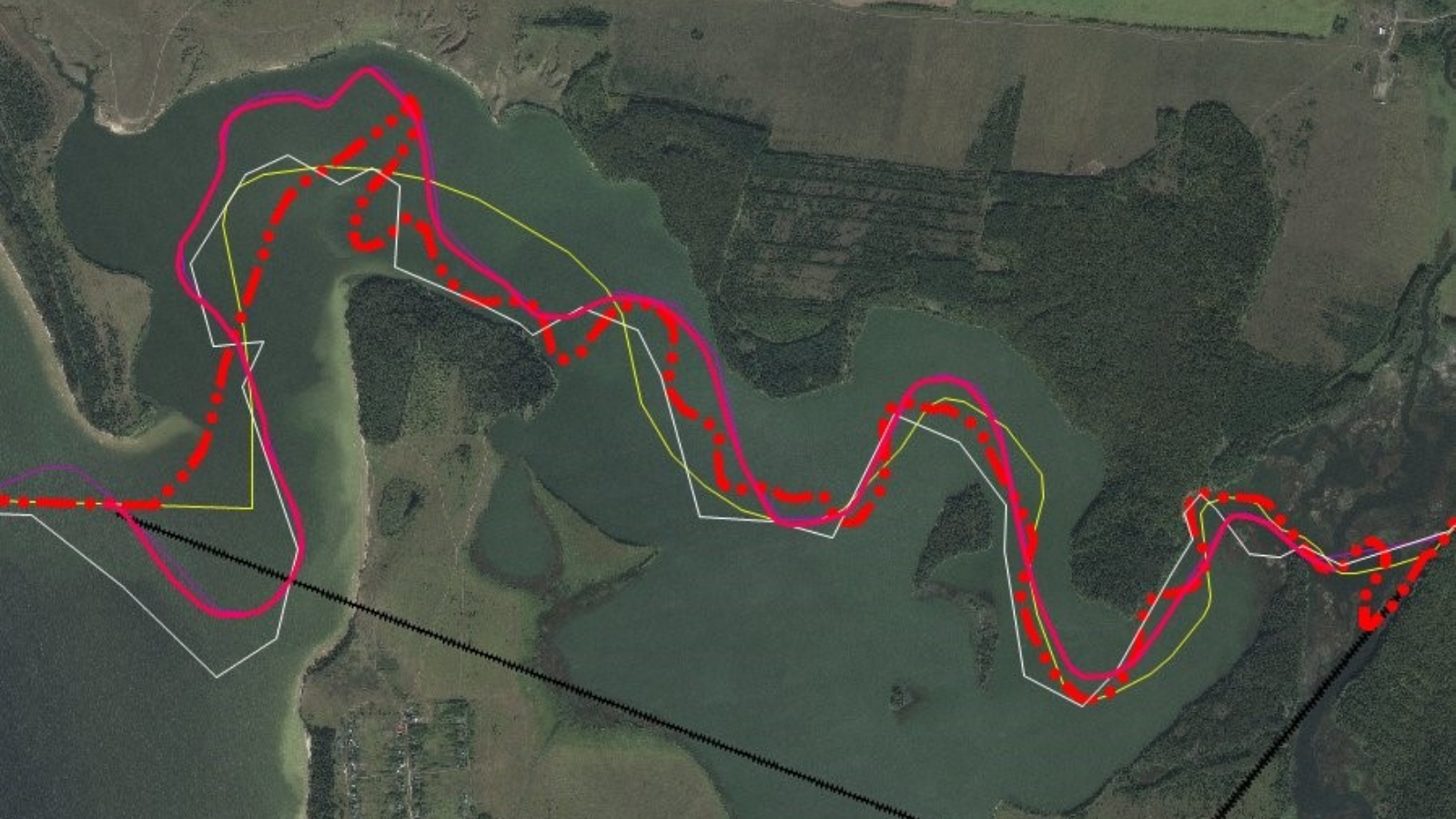
The border of the Republic of Tatarstan in the area of the Utka River can pass in the middle of the bay
The head of the department of geodesy and cartography of the State Budgetary Institution Spatial Data Fund of the Republic of Tatarstan Andrei Logashin spoke about the progress of work on establishing the border of the Republic of Tatarstan during the next meeting of the working subgroup. The meeting was chaired by Timur Khabibullin, head of the cadastral relations department of the Ministry of Land Property of the Republic of Tatarstan.
Andrey Logashin presented a draft of the border crossing between Tatarstan and the Samara region for approval by the working subgroup. Until today, 5 disputed areas remained unresolved. The Spatial Data Fund has prepared a project based on the principle of maintaining the balance of areas. During the discussion, all participants agreed with the presented project.
Also, work continues with the adjacent border of the Republic of Tatarstan and the Ulyanovsk region. Here, 7 disputed areas remained unresolved. 3 of them were decided following the results of a working trip of representatives of the Spatial Data Fund of the Republic of Tatarstan to the Ulyanovsk region. The parties agreed that the plots in the area of forest belts will share flat plots, observing the balance of areas. The issue in the area of the Utka River is under discussion. Here the border can run in the middle of the bay.
During the meeting of the working subgroup, the participants planned field events for more effective work to clarify the border.
The discussion was attended by representatives of the Ministry of Economic Affairs of the Republic of Tatarstan, the State Budgetary Institution Spatial Data Fund of the Republic of Tatarstan, the branch of the Federal Cadastral Chamber of the Federal Service for State Registration, Cadastre and Cartography for the Republic of Tatarstan, the Office of the Federal Service for State Registration, Cadastre and Cartography for the Republic of Tatarstan, the Ministry of Forestry of the Republic of Tatarstan ...