Fanil Agliullin held a regular meeting of the working subgroup on establishing the border of the Republic of Tatarstan with the Chuvash Republic
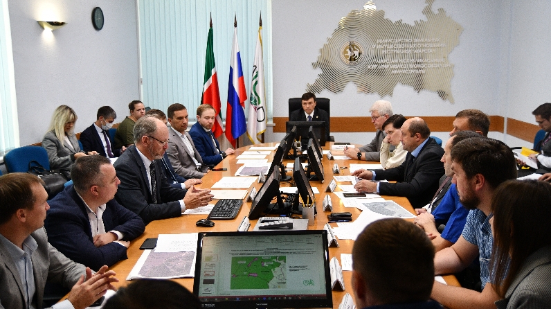
On September 4, 2020, the meeting of the working subgroup under the chairmanship of Minister Fanil Agliullin on establishing the border of the Republic of Tatarstan with the Chuvash Republic was held at the Ministry of Land and Property of the Republic of Tatarstan.
The meeting was attended by representatives of the Ministry of Forestry of the Republic of Tatarstan, State Budgetary Institution Spatial data fund of the Republic of Tatarstan, the Office of the Federal Service for State Registration, Cadastre and Cartography in the Republic of Tatarstan, the Branch of federal budgetary institution Federal cadastral chamber of the Federal Service for State Registration, Cadastre and Cartography in the Republic of Tatarstan, the Executive Committee of the Drozhzhanovsky municipal district of the Republic of Tatarstan.
The meeting of the working subgroup was also attended by representatives of the Ministry of Construction, Architecture and Housing and Communal Services of the Chuvash Republic, the Ministry of Natural Resources and Ecology of the Chuvash Republic, the Office of the Federal Service for State Registration, Cadastre and Cartography in the Chuvash Republic, Branch of federal budgetary institution Federal cadastral chamber of the Federal Service for State Registration, Cadastre and Cartography in the Chuvash Republic and Earth LLC.
During the meeting of the working subgroup, the project border of the Republic of Tatarstan, adjacent to the Chuvash Republic, was discussed, the length of which is over five hundred kilometers. Apastovsky, Buinsky, Zelenodolsky, Drozhzhanovsky and Kaibitsky districts of the Republic of Tatarstan are located on the border.
In addition, controversial issues were discussed regarding the description of the administrative-territorial border between the Republic of Tatarstan and the Chuvash Republic, as well as the requirements of the Federal Service for State Registration, Cadastre and Cartography to verify the compliance of the declared values of accuracy of characteristic points of cadastral plots with materials of boundary files.