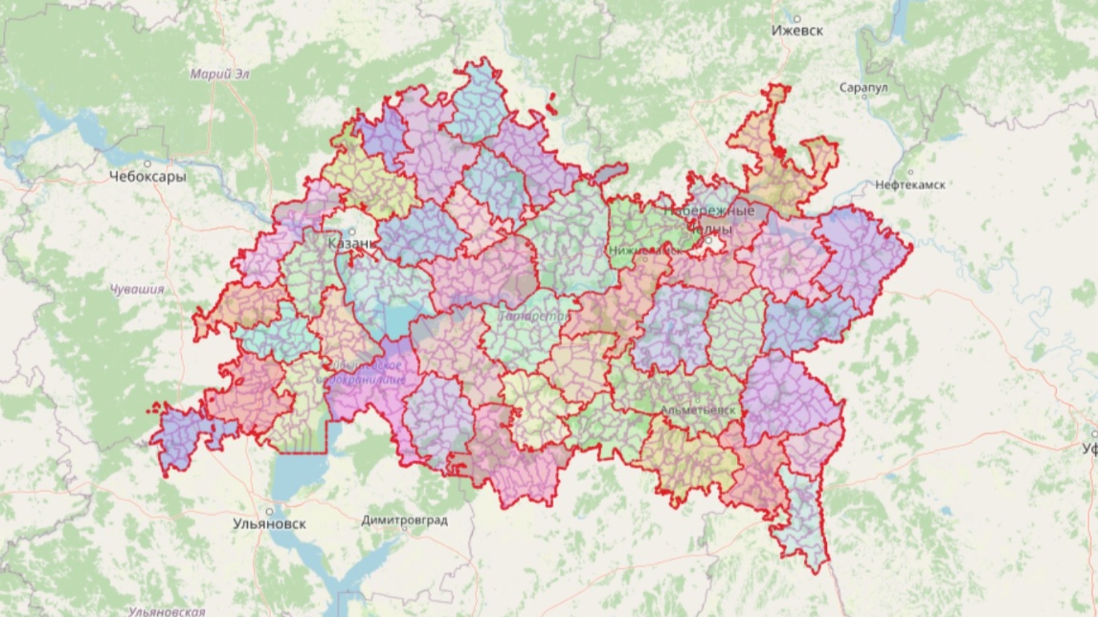
Work to establish the boundaries of settlements continues
4 October 2022, Tuesday

On October 4, a regular weekly meeting of representatives of the State Budgetary Institution "Spatial Data Fund of the Republic of Tatarstan" and the Office of Federal service of state registration, cadastre and cartography in the Republic of Tatarstan was held, where they discussed the progress of work on making changes to the territorial planning schemes (TPS) of municipal districts.
Currently, the Spatial Data Fund of the Republic of Tatarstan is actively working in 27 municipal districts, which include 894 settlements. 302 borders of settlements were sent to the Cadastral Chamber for subsequent inclusion in the Unified state register of real estate. There are 285 boundaries included in the real estate register.
Share:
LATEST NEWS
29
April 2023
Today, the staff of the Ministry of Land Property of the Republic of Tatarstan and subordinate institutions supported the international action "Garden of Memory". The event is dedicated to the 78th anniversary of the Victory in the Great Patriotic War and the Year of National Cultures and Traditions in Tatarstan. Employees went to the Laishevsky district, where they planted coniferous trees near the village of Tarlashi.
On a land leased from the state, you can first build a house, and then buy the land. How to properly lease land, where to start the procedure for acquiring and registering a land plot that is in state or municipal ownership, as well as what are the nuances of drawing up an agreement - Artur Galiev, First Deputy Minister of Land and Property of the Republic, spoke about this.
On April 27-28 in the IT park named after Bashir Rameev, experts of Public legal Company Roscadastre held a training seminar on working with the services of the federal state information system "Unified Digital Platform "National System of Spatial Data" for the relevant ministries and departments of the Republic of Tatarstan, the press service of the branch of the Public legal company "Roskadstr" reports in the Republic of Tatarstan.
28
April 2023
Deputy Minister Edik Diyarov delivered a welcoming speech at the Kazan Polytechnic College to the participants of the All-Russian campaign "Victory Dictation".
SUBSCRIBE FOR NEWS
All content on this site is licensed under
Creative Commons Attribution 4.0 International
If you see a mistake,
please select the word or sentence and press CTRL+ENTER